Chennai does not need a new plan. It needs its existing commitments made visible — located, sequenced, and costed in the city’s own terms.
The Vision for Chennai sets out eight targets under Sustainable Development Goal 11. They are the right eight. Read as policy, they are precise. Read as a city, they are still abstract: a percentage of residents near a bus stop, a square metre of green per person, a share of heritage stock conserved.
Our contribution is the translation. Every target in this document is pinned to a place — a river, a marsh, a station, a shoreline — and to a decade. Three of the eight carry the rest, and we treat those three at depth: water, movement, and the public realm.
The remaining five are not lesser. They are largely delivery problems — capacity, coverage, compliance — and they resolve when the first three are structured properly. Housing follows transit. Waste follows collection routes. Regional balance follows the corridor.
Nothing here proposes demolition of a settled community, and nothing here asks Chennai to look like somewhere else. Where we cite Singapore, Barcelona or Copenhagen, it is to establish a floor, never a template.
Where the city actually stands, stated honestly.
A conservative estimate of the population living in slum settlements — roughly a third of the city, and the single largest test of whether growth is shared.
Share of residents within walking distance of a high-frequency bus service (ITDP). The same figure — coincidentally — describes access to open public space.
Green space per resident. The World Health Organization treats 9 m² as a minimum, not an ambition. Chennai’s 2040 target is the world’s floor.
Lost every year to severe heat alone, before a single flood is counted. Climate is not a chapter of this plan; it is the plan’s operating condition.
Figures as stated in the Vision for Chennai, 2026. Sources cited in the reference appendix.
Two rivers, one canal, one marsh, one shore.
Chennai’s geography is unusually legible. The Cooum and the Adyar run west to east; the Buckingham Canal ties them north to south; the Pallikaranai marsh holds the water the city cannot absorb; the Bay of Bengal takes what is left.
Every target in the vision document intersects at least one of these five elements. That is the organising insight of this proposal: the city already has a spatial framework. It has simply been built over.
Diagrammatic. Not to scale; for structural reading only.
A digital twin
of Chennai.
Every target in this vision is a number that must be measured, in the same way, every year, for fourteen years. Today the city cannot do that.
A digital twin is not a visualisation. It is a single, continuously updated model of the city — terrain, hydrology, built fabric, networks and live sensor readings held in one coordinate system — against which any proposal can be tested before it is consented, and any target can be checked without commissioning a new study.
It is the key thing in this document and the first thing that should be built. The 2026 baseline the vision calls for is not a report; it is the twin’s first snapshot. Every figure after it is a comparison against that same model.
Built once, owned publicly, and open to civil society — which converts the vision’s commitment to citizen participation from a consultation exercise into shared evidence.
- 05Live sensing
- 04Utilities & drainage
- 03Mobility network
- 02Built fabric
- 01Terrain & hydrology
Four questions the city currently answers with an opinion.
The twin earns its cost the first time a scheme is refused on evidence, or a flood is anticipated a day earlier.
Where will it flood this November?
Rainfall run through terrain and drainage, street by street, before the monsoon rather than after it. The same model tests whether a proposed development moves water onto its neighbours — which is the disaster risk assessment the vision already requires, made objective.
Who is actually within walking distance?
The thirty-six percent figure becomes a live map of real walking routes, not straight-line radii. Add a feeder route and the number moves the same day — so the city can see which interventions buy the most access per rupee before committing.
Which streets are costing us the $1.9 billion?
Surface temperature against canopy cover, at neighbourhood grain, identifies where thirty percent canopy should be planted first. Heat is the city’s largest measured economic loss and its most spatially uneven one.
Are the same people still living here?
Tracked over time, the twin makes displacement visible while it is happening rather than a decade later — the evidence base for the displacement test we propose at every approval, and for the land-to-population consumption ratio under Target 11.3.
Delivered in Phase I. Publicly owned, openly licensed, maintained as permanent civic infrastructure.
Eight targets. Three carry the weight.
Sustainable Development Goal 11 gives the vision its spine. We keep all eight targets intact and add only a hierarchy of effort — because a plan that treats every priority equally sequences nothing.
Give the water
somewhere to go.
Chennai floods and Chennai runs dry, often in the same year, for the same reason: the surfaces that once held water have been given other work to do.
The vision document commits to restoring the ecological health of the Cooum, the Adyar, the Buckingham Canal and their estuaries, and to protecting the whole of the Pallikaranai marsh. Read spatially, these are not four projects. They are one continuous hydrological system that the city has been dismantling piecemeal for a century.
We propose it be restored as one: a single legal and design boundary drawn around the rivers, the canal, the marsh and every natural drainage channel between them — surveyed once, mapped publicly, and made unbuildable. Inside that boundary, the work is ecological. Outside it, every new development carries a disaster risk assessment as a condition of consent, as the vision already requires.
This is what makes the fifty-percent reduction in disaster losses achievable rather than aspirational. Early warning systems reach everyone; hospitals meet resilient standards; but neither prevents the flood. Only the drainage does.
Move the majority,
not the minority.
Thirty-six percent of residents can walk to a frequent bus. Sixty percent is the target. That twenty-four-point gap is the most consequential number in the entire vision.
It decides whether the twenty-five percent travel-time reduction is delivered by better traffic signals or by fewer cars. Only one of those compounds. Intelligent management of Koyambedu and Valasaravakkam will buy real minutes — but it buys them once, and induced demand takes them back.
The durable move is the walk to the stop. We propose the city’s capital priority be inverted: fund the first and last mile — footpaths, crossings, shaded waiting, feeder routes into interior neighbourhoods — before any further carriageway widening. Climate-resilient road surfacing follows the same logic; a road that survives the monsoon is a bus route that survives the monsoon.
Electrification — charging infrastructure at depots, interchanges and public buildings — cleans the fleet. It does not, by itself, move anyone.
Heritage is public
space, or it is storage.
Conserving every government-owned heritage building is the correct commitment. Conserving them as offices would waste it.
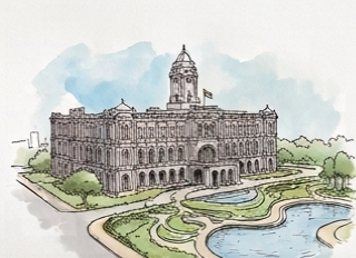
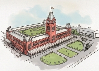
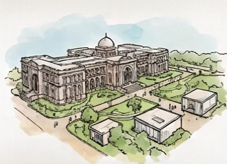
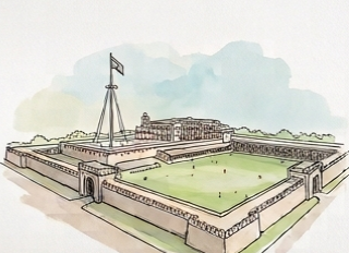
Chennai holds one of the finest nineteenth-century civic building stocks in Asia — Ripon, Egmore, the Museum campus, the Fort, the High Court. Most of it is inaccessible to the citizens who own it. Restoration should therefore be paired with a change of use wherever function permits: ground floors, courtyards and grounds opened to the public as a matter of policy, upper floors continuing to govern.
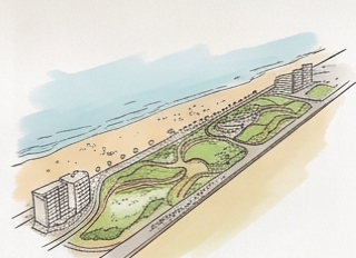
That single decision does the work of two targets at once. It delivers heritage conservation, and it moves the open-space figure — thirty-six percent today, eighty percent committed — without acquiring a square metre of land.
The new institutions the vision calls for — museums, a world-class auditorium — should be sited to complete these precincts rather than to start new ones. And the ordinary infrastructure of a usable public realm holds throughout: lighting, sightlines, clean toilets, shade, and space where children can play unsupervised. A park that a parent will not enter after dark is not counted in our numbers.
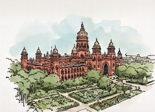
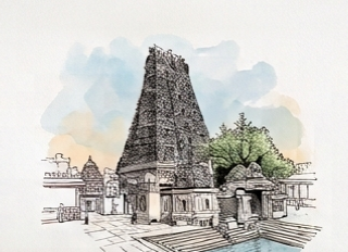
Delivery problems, stated as delivery problems.
These five targets need capacity, coverage and enforcement rather than design invention. We set them out plainly so the plan does not mistake ambition for difficulty.
Resettlement inside the city, never outside it
Thirty lakh residents cannot be relocated to the periphery without destroying the livelihoods that brought them here. Rehousing stays within the existing urban fabric, at mixed densities, with water, healthcare and transit present on day one — not promised for phase two. Education and skills programmes run alongside the build, not after it.
Land consumed no faster than population grows
A ratio, published annually, that disciplines every consent. Alongside it: civil society seated in planning as a standing right rather than a consultation event; a threefold increase in veterinary and animal-control capacity to make streets safe for children; and clean public toilets treated as basic infrastructure.
Segregate at source, process everything
Door-to-door collection and source segregation at full coverage, all municipal solid waste processed, landfill minimised, and ninety-five percent industrial compliance with air and pollution standards. Air quality is the outcome these produce; it is not a separate programme.
Nine square metres, thirty percent canopy
Per-capita green space from 7.42 m² to 9 m², access to open space from thirty-six to eighty percent, and urban canopy cover to thirty percent. Canopy is also the cheapest instrument the city holds against the $1.9 billion it loses to heat each year.
Grow the satellites so the core can breathe
Eighty percent of new growth directed into planned corridors and satellite towns, with global capability centres placed there to put high-income work beside housing. Primary health centres within reach, a coherent state-wide transport network, and private and omni bus operations properly regulated at the city edge.
Three cities that solved one thing each.
Not models to copy. Evidence that the targets in this document are ordinary achievements elsewhere.
Turned drainage into public space. Rivers and canals were re-naturalised as parkland that floods on purpose — the same instrument Chennai needs for the Cooum and the Adyar.
Reclaimed street area for people without new land, by reorganising traffic across groups of blocks. Directly relevant to raising open-space access from thirty-six to eighty percent.
Shifted mode share by spending on the least glamorous element — the continuous, protected first and last mile — over four decades of consistent policy.
Indicative comparisons. Full benchmarking to be developed with CMDA in the baseline study.
Three phases. Each one leaves the city better even if the next never comes.
Measure and protect
- Digital twin built; baseline published as its first snapshot.
- Water boundary surveyed and legally fixed; Pallikaranai secured.
- First and last mile funded ahead of carriageway widening.
- Full door-to-door collection and source segregation.
- Early warning coverage to every resident.
Build and open
- River and canal restoration works; natural drainage reinstated.
- Bus access reaches sixty percent of residents.
- Heritage precincts restored and opened to the public.
- In-city rehousing programme at scale, no displacement.
- New museums and the civic auditorium delivered.
Balance the region
- Eighty percent of new growth in planned corridors and satellites.
- Canopy cover at thirty percent; green space at 9 m² per person.
- Disaster losses halved against the 2026 baseline.
- Chronic flooding eliminated in identified high-risk areas.
- Metropolitan governance consolidated and permanent.
One boundary, one budget, one accountable body.
Chennai’s targets are shared across agencies whose boundaries do not coincide with the metropolitan area, with each other, or with the watershed. Every deep-treatment move in this document fails at that seam.
We recommend a standing metropolitan coordination body with statutory authority over the water boundary, the transit corridors and the growth corridors — publishing a single annual scorecard against these targets. Coordination that is voluntary is coordination that ends with the next administration.
Non-displacement is a design constraint, not a mitigation.
Restoring a river, opening a precinct and upgrading a corridor all raise land value. Left alone, each one displaces the households the vision is meant to serve, and the plan quietly reverses its own equity target.
Every project in this programme should therefore carry a displacement test at approval, in the same way it carries a disaster risk assessment. If a scheme cannot demonstrate that existing residents remain, it is not ready.
The measure of this vision will not be the buildings. It will be whether an ordinary resident, in 2040, can walk to a bus, sit in a park after dark, and stay dry in November.